709-218-7927 The Landfall Garden House 60 Canon Bayley Road CANADA A0C 1B0 |
|
|---|
.JPG)
Toronto Transit Commission (ōThe TTCö)
Ride all Day
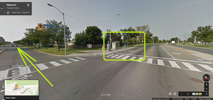
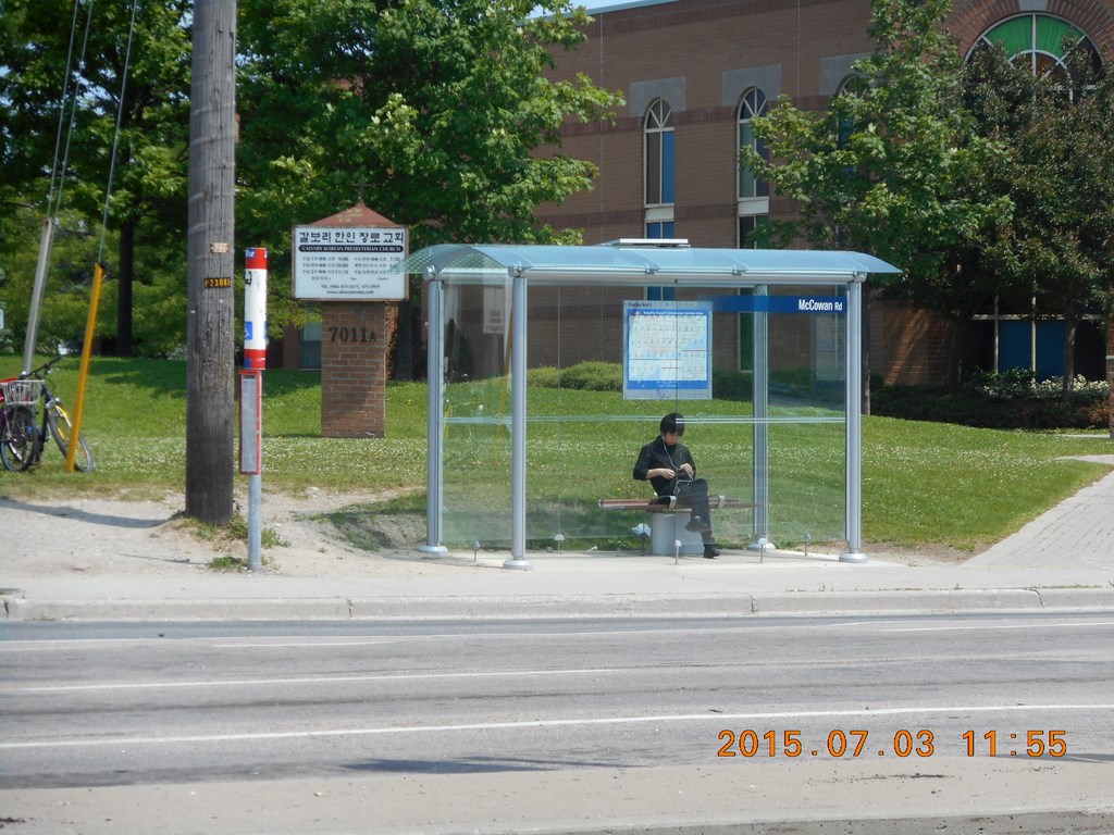
If you are concerned about standing in the rain while you wait for a surface-vehicle transfer you can always use Street View in Google Maps to check out bus shelters.
If I were transferring to an eastbound Steeles Avenue bus at Kipling, I see that there is a shelter! My arrow is pointing south down Kipling, my Steeles bus would arrive from the right. I would be almost dry in the bus shelter. (The Toronto Transit CommissionÆs idea of a shelter from the rain is one with a gap between the roof and the walls so that the rain drives in and soaks the seat; donÆt get me started ...)
Friday, July 03, 2015
The plan was to make a ride that took in a cross-section of the city. I have Chris-crossed (hah!) Toronto by car and by Toronto Transit Commission and even on foot over 30+ years, so most of these routes are nothing new. But if you were here with the best part of a day to kill, this route would give you a great view of the city while keeping you in contact with any traveling companions.
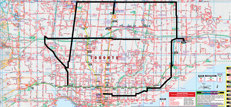
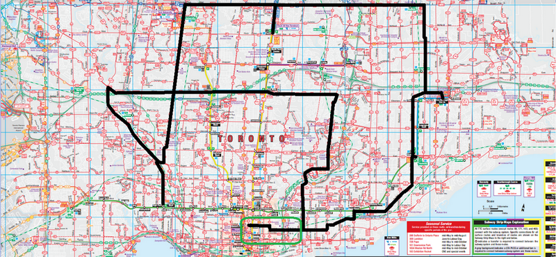
506 Streetcar College to Main Subway Station
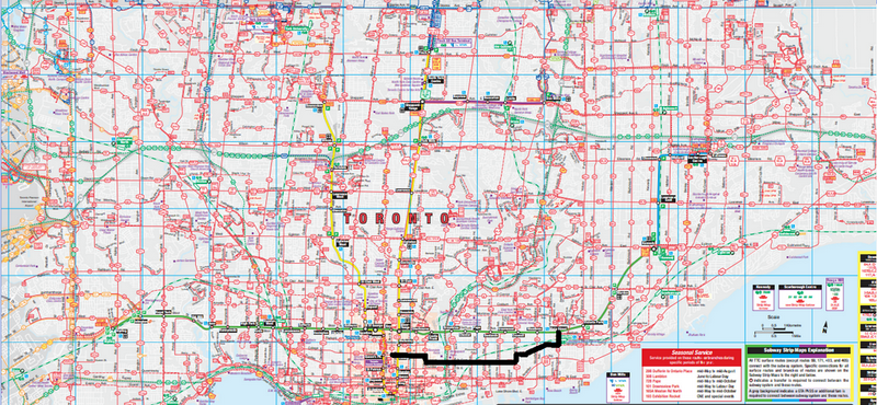
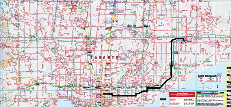
The first of a series of maps. The black line shows this leg of my journey, starting in the downtown core and moving east to Main Street Subway Station on the Bloor-Danforth line.
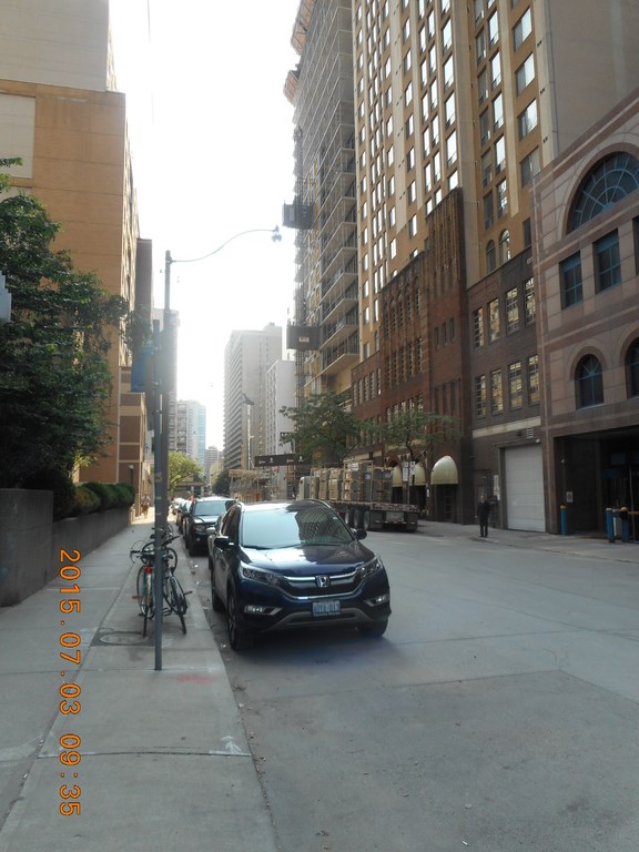
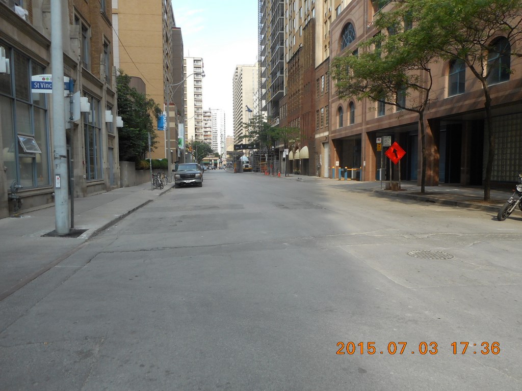
I often take a ōfirstö and ōlastö photo as timestamps of my journey. The time is 9:30 and I am leaving the gritty street with its two condominium towers under construction and heading off with a packed lunch, fruit, and water bottle in my shoulder bag.
I hop on the next eastbound streetcar (at this time of day a wait of only five minutes) and head east.
Now this is a stretch of Toronto that I walk or ride often enough, but today I notice how fascinating is the area around Gerrard Street and Broadview Avenue. I ask myself why I have not jumped on a streetcar and spent an hour or two wandering (again) around this district.
We travel through a Indian district around Ashdale between Greenwood and Coxwell Avenues. I ask myself why I have not jumped on a streetcar and enjoyed an evening supper this district.
113 Bus Main to Kennedy Subway Station
We trundle into the subway station at Main Street and I note with intense delight that there are no buses in the bays; none at all. This is a Good Thing because each time a surface vehicle pulls into a subway station I am to hop off and find a transfer-dispensing machine; these are usually found just inside the system, which means I usually have to walk to the Exit point to grab a transfer and then walk back. No buses in the station means I have plenty of time to grab a transfer and get back to the bus bays.
Which I do.
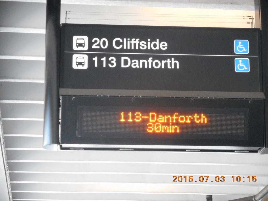
My second leg is the 113 bus along Danforth Avenue and in the time it takes me to whip out my camera to take a photo on the still-empty bus bays and take a shot of an automated sign that tells me that my bus is due in one minute, and the next bus in thirty-one minutes, the sign changes to tell me that the non-existent bus right alongside me has come and gone.
What?
I take a photo anyway and the sign changes to inform me that my wait will now be 29 and 59 minutes respectively.
So I do what IÆm good at, and wander over to chat with a couple of ladies. ōAre you waiting for the 113 bus?ö. They have seen me taking a photo and smile; yes. And no, I didnÆt miss it. The signs often do that.
Huh?
About four minutes later the bus pulls in, the doors open, we pile in, the doors close, and we shoot off.
One lady tells me that this route ¢ like several others ¢ allows no leeway in boarding; in, and out, thatÆs the mode of operation. If you blink, you miss it.
BEWARE!
These signs are NOT tied to actual buses. The data (to call it information would give the lie to my career) is merely a fantasy in the mind of whoever programmed the rubbish. The signs merely tell you the times at which the Toronto Transit Commission had planned buses to run.
The day after Global Nuclear War on all World-Class cities, these signs will still be telling us when the buses might have arrived were we not all dead.
We head off to Kennedy Subway Station.
43 Bus to Scarborough Town Centre Subway Station
One of the concerns of the all-day rider will be Washrooms.
Take with you a list of washroom-equipped subway stations. Kipling, at the western terminus, has washrooms; Kennedy, at the eastern terminus, does not. Both stations were built at the same time (early 1980) when washrooms were known to mankind.
I had planned to jump on a #57 north up Midland Avenue, and checked my map. I turned to walk through the doors to the bus platform where my #57 bus suddenly stopped idling and rushed away without me.
No Sweat! I am retired AND on vacation in my own town.
I could have taken the 86 all the way to Toronto Zoo, a lengthy trip for a healthy lad.
I missed the #43; according to that incorrigible display scheme it had left the terminus early. Or just never arrived, take your pick.
So I waited patiently on the bus platform for the next #57. The display ticked down: ō7 minutesö, ō5 minutesö, ōDueö, ō8 minutesö.
How can a bus arrive right alongside where I stand and me neither see nor hear it? Nor any other of the passengers waiting for it?
Once again: BEWARE!
These signs are NOT tied to actual buses. The data is merely another Toronto Transit Commission fantasy.
Eagle-eyed I watched the arriving buses and when a #43 pulled in I pushed aside little old ladies and little young ladies with babies in stroller carriages because I was growing old waiting for a suitable bus and want to die happy.
As we pull out of the terminal a #57 pulls in. Is this the #57 that had not appeared? Or is this another #57 which will pop-in, and pop-out again ahead of schedule?
Is the Go Transit Dispatcher moonlighting as a Toronto Transit Commission dispatcher? Holding down two jobs in case he gets fired from one of them?
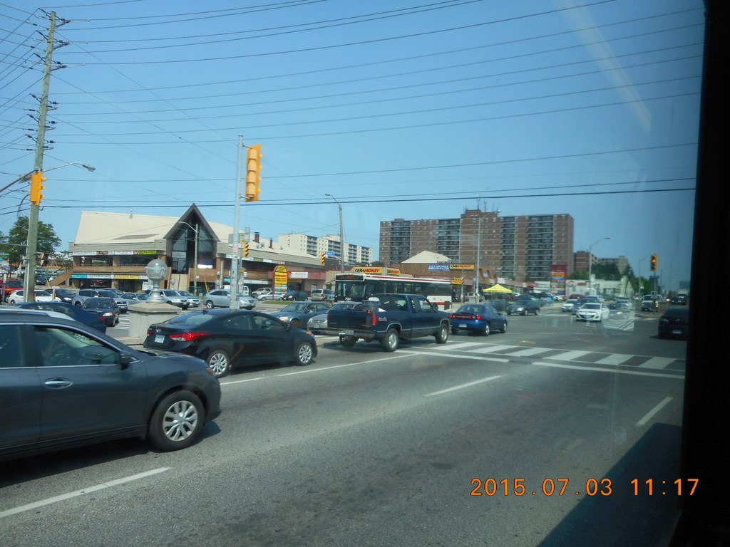
Here we are rolling through what once used to be rolling farmland but is now plazas and strip malls in this part of Toronto.
There is no reason why I couldnÆt break my journey and wander a mall or treat myself to a greasy breakfast or lunch. IÆd use an extra ticket itÆs true, but IÆd still be demonstrating that one could ride all day on a single fare.
DonÆt worry! WeÆll be seeing green fields and forests soon enough.
We pull in to the Scarborough Town Centre off Progress Avenue
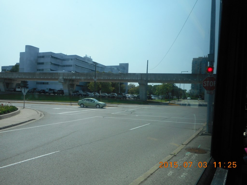
This is a shot of the Scarborough Rapid Transit elevated track. I recently made arguments against the arguments that the Gardiner Expressway blocks access to TorontoÆs Waterfront. Elevated roadways and elevated railways do not block access. Look at all the room between the piers. Elevated MIGHT be ugly ¢ nothing that a coat of weather-resistant green paint wouldnÆt fix ¢ but elevated systems allow easy access across their line of travel.
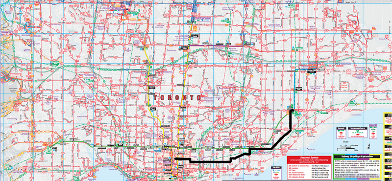
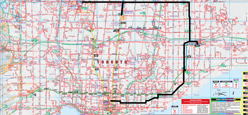
129B Bus to Steeles Avenue
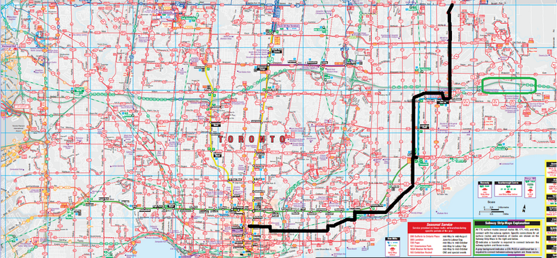
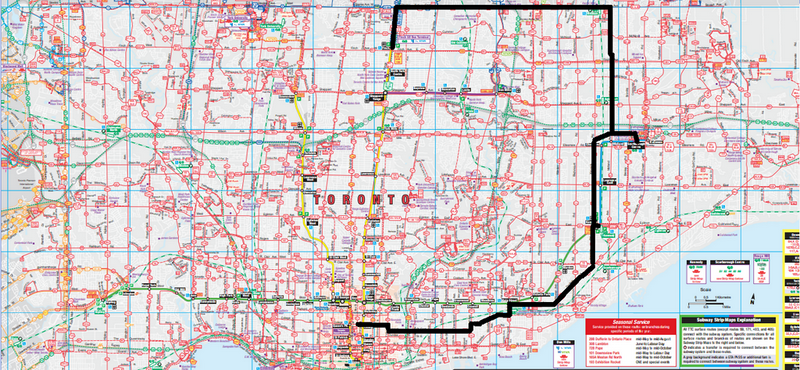
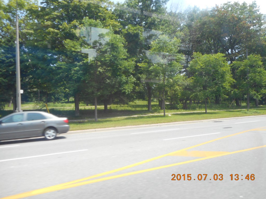
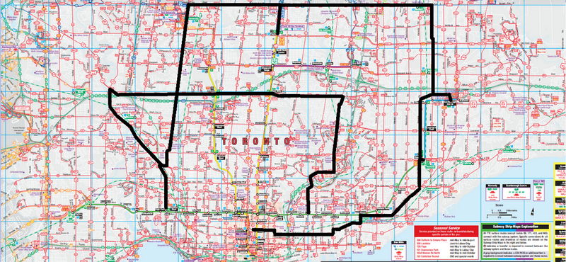
Note the green rectangle on the map; I drew that rectangle to draw your attention to the faint gray markings that show the 401-highway ¢ CanadaÆs busiest roadway. You wonÆt find it on your Toronto Transit Commission maps because the Toronto Transit Commission in its infinite wisdom has decided to suppress much useful detail from its maps.
This penalizes newcomers to the Toronto Transit Commission ¢ out-of-town visitors and residents migrating from cars to public transit ¢ because it reduces the number of confirming landmarks and leaves riders feeling insecure about where they are and hence how far it is to their destination.
To compound matters, the automated announcement calls out and displays the stop ōHighway four-oh-oneö. ThereÆs just no sign of it on your map! And truth be told, thereÆs not much to do at the stop except stare at the various on- and off-ramps. Anything worth visiting is at the preceding or succeeding stop.
Scarborough Town Centre subway station has no washrooms either. I ask at the ticket wicket, and the Toronto Transit Commission guy says I can find washrooms in the shopping mall. This means that IÆll have to pay an extra fare to the Toronto Transit Commission just to use washrooms that are not theirs.
Welcome to Toronto!
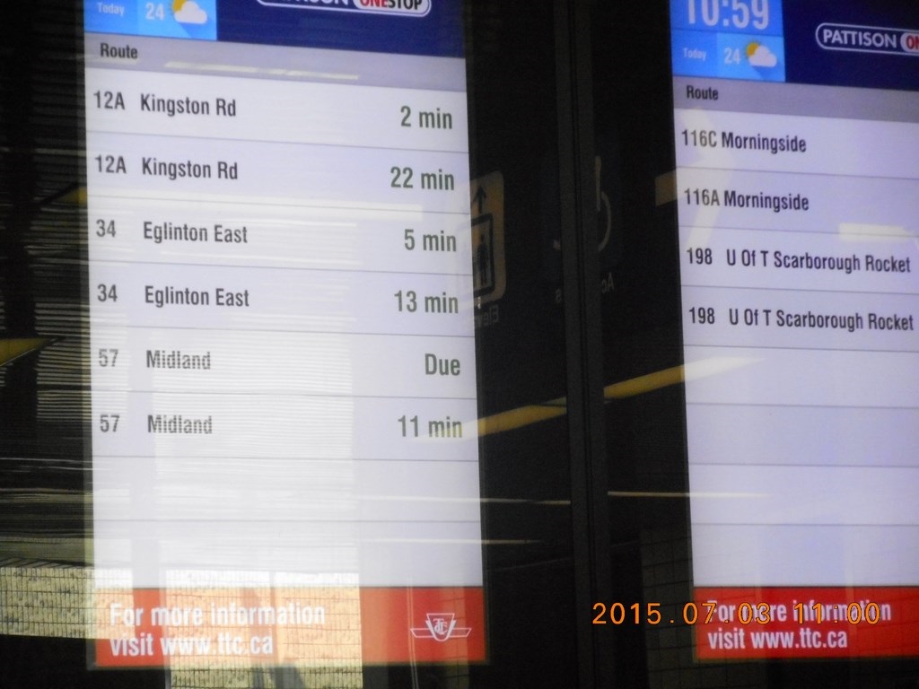
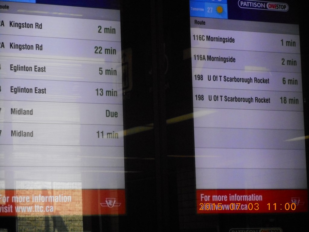
Here is the illuminated sign which I have learned to distrust.
What is this ō198 U Of T Rocketö (UofT=University of Toronto). I study my map again, and then ask the driver of the 198. He canÆt find it on my map either! Turns out that my map is 6 months old. When I return home I find that it IS marked on the newer map, but in pale green ink rather than the deep red for surface routes.
I think that the 198 is the Toronto Transit CommissionÆs way of connecting me with Durham Regional TransitÆs #900 route that takes me right across Durham Regional Transit on an east-west route.
More research needed here!
I did find it odd that the driver of the route didnÆt find it odd that his route was not marked on his map.
Maybe he was rushing off to use the washrooms; the staff washrooms.
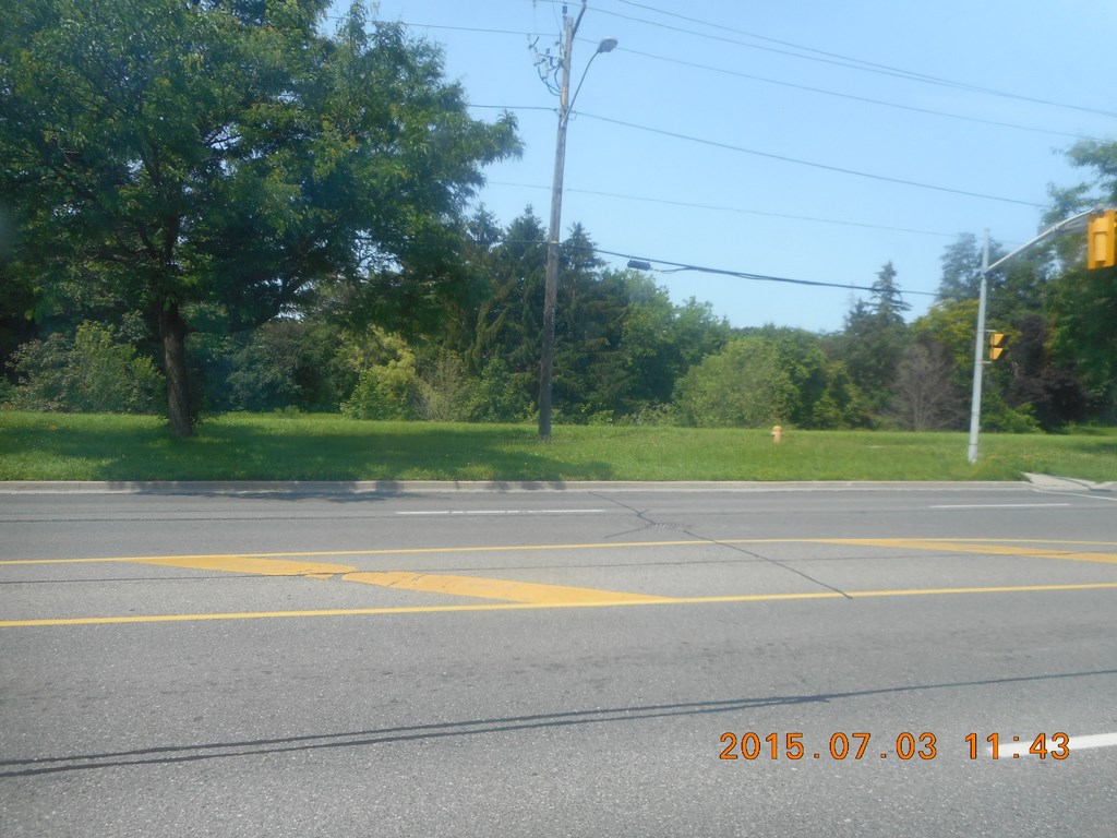
We head north up McCowan Road. I TOLD you weÆd be seeing greenery soon!
As we wait to cross Finch Avenue I see a ō199 Rocketö; this appears to be one of the new express routes, pale green, and it shuttles between Scarborough Town Centre and Finch Subway Stations. Why didnÆt I take this bus instead of playing musical chairs with the #43, #57, #129B and 60W routes?
(Makes note to self: Must plan a day riding all the pale green Rocket routes)
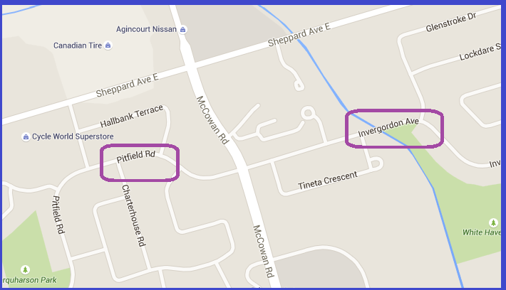
Just south of Sheppard Avenue we roll through a bus stop announced as ōInvergordon Avenueö. My seat on the left-hand, west side of the bus gives me a great view of Pitfield Road.
This is an inconsiderate (in my humble opinion) approach to signage in the Toronto Transit Commission system. If my plan were to visit my friend on Pitfield Street, or my client had told me ōget off at Pittfield Streetö there would be no notice of the stop, because Pitfield is on the other side of McCowan Road, so Pitfield does not exists for northbound buses. No matter that you need just to get off the bus at Invergordon and cross to the other side of McCowan Road.
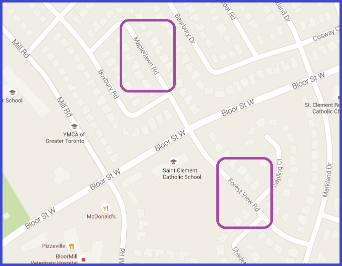
You see (or rather donÆt see or hear) this all across Toronto. Over on the 49B Bloor Street route it is ōMapledawn Roadö on the north side, westbound and ōForest View Roadö on the south side on the way back!
At Steeles Avenue I hop off the bus on the south side of Steeles Avenue and wait for the lights to change green so that the bus and I can cross Steeles, the bus to pull up at the bus stop on the north side, me to ignore the bus and join the young man in the bus shelter.
53 Bus to Finch Subway Station
I sit and observe the next 129B bus pull up, not two minutes behind ours. For all that the Toronto Transit Commission has for the past 30 years had the ability to track each bus every revolution of the wheel (literally!) with signals being communicated between road-side stations and the control centre, they are still absolutely hopeless at spacing transit vehicles to provide a service to customers.
Now this may seem cruel of me: How can I castigate the Toronto Transit Commission for being behind schedule and then complain when they try to catch up to schedule?
ItÆs all about predictability. ItÆs my belief that passengers would rather travel on schedule that travel early or late.
See for example the Peterborough Transit System where all twelve routes leave the terminal within two minutes, every forty minutes. No ifs ands or buts. And hereÆs the point: If you arrived at the terminal by one route to make a connection to a second route, YOU WILL NEVER FAIL TO MAKE THE CONNECTION! .
At 1159 I board the westbound #53 and have to show a transfer for the first time; this is my first bus/bus connection outside of a subway station.
If you have been keeping track of subway stations you will realize that by now I have accumulated a wad of incriminating transfers. What is the tourist-looking chap (orange shoulder bag, floppy hat) trying to prove? Why is he fumbling through a half-dozen transfers?
So I have developed a cunning plan where the latest transfer sits in my shirt pocket and older transfers are crammed into a pocket of my wallet. Look! IÆm just a regular traveler! Walked into Scarborough Town Centre, paid my fare and got a transfer on my way to visit my aunt on (fill in a name here) street.
As we proceed on our merry way, an even merrier #53 westbound overtakes us and we play leap-frog all the way to Finch Subway Station. I wonÆt repeat my comments about the Toronto Transit CommissionÆs problem with scheduling except to say that for all that the Toronto Transit Commission has for the past 30 years had the ability to track each bus every revolution of the wheel (literally!) with signals being communicated between road-side stations and the control centre, they are still absolutely hopeless at spacing transit vehicles to provide a service to customers.
60 Bus to Keele Street
So here we are at Finch Subway Station bus terminal. All the usual gripes apply. I board a #60 westbound and head for Keele Street.
I almost know this stretch of road, because for years I had travelled the #35 Jane NORTH to Steeles to meet my canoeing buddy Fred. I am therefore used to seeing #60 westbound and eastbound harry (as in ōthey look harriedö) along Steeles Avenue; now I am on one of these buses. Nothing to it. When the sign announces ōKeele Streetö IÆll hop off on the north side of Steeles (we are after all traveling westwards!) and cross to the south-west corner of the intersection to catch a southbound bus.
But whatÆs this! The Toronto Transit Commission has yet-another-surprise in store for me.
As we approach Keele the bus moves over to the left-turn lane. This bus doesnÆt go all the way to the other side of highway 427; that would be the #60D and I am on the humble #60C which runs to York University which does not yet (but see later) have its own subway station.
I check with the driver about my connection (always a good idea in any city on any transit system) and he tells me not to wait at the southbound bus-stop on the SW corner, but to wait at the eastbound stop on the SE corner, because the #41 southbound bus will arrive from the west, cross Keele Street, pick me up, and then loop south and west around Petrolia before making up its mind to head south down Keele.
Glad I asked!
As is my wont I strike up a conversation with the lady who crossed with me. Oh yes, she says brightly, it surely can be confusing this business of waiting eastbound for a southbound bus.
But whatÆs this! The Toronto Transit Commission has yet-another-surprise in store for me.
The lady then tells me that on Saturdays the bus just turns down Keele! So if tomorrow I was here, IÆd be in the wrong place!
How confusing is that?
41 Bus to Keele Subway Station
The bus arrives; we board the bus, head east (back the way we came) and turn south onto Petrolia. As we meander through the back streets searching for Keele Street we are overtaken by another 41S Keele bus and we play leap-frog all the way to Keele Subway Station. I wonÆt repeat that I wonÆt repeat my comments about the Toronto Transit CommissionÆs problem with scheduling except to say that for all that the Toronto Transit Commission has for the past 30 years had the ability to track each bus every revolution of the wheel (literally!) with signals being communicated between road-side stations and the control centre, they are still absolutely hopeless at spacing transit vehicles to provide a service to customers.
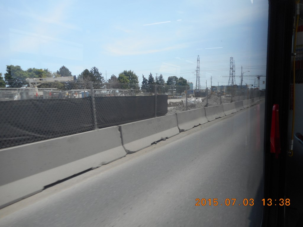
And here we are barreling down Keele Street in the vicinity of York University. I believe that this street-blocked-off construction is the extension to the Spadina Subway Line, a project that nowadays competes with the non-arrival of Bombardier streetcars for the surface routes.
ItÆs not only buses that get delayed, itÆs entire transportation projects that are running late by several years.

More work further south. I have no idea what these pillars of the community are going to hold up.
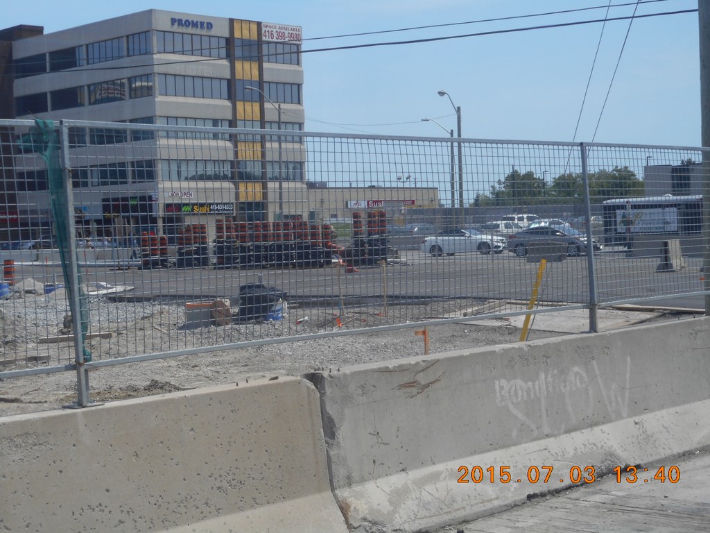
I could look up ōPromedö on the internet and let you know where I was when I took this photo. Eglinton, I think. No. That came later. This is probably Lawrence (which of course is York Mills on the other side of Yonge Street)
More greenery as we head south. The day so far has been a mixture of truly gritty downtown crud, 1960Æs shopping plazas, and appealing forest glades and parks.
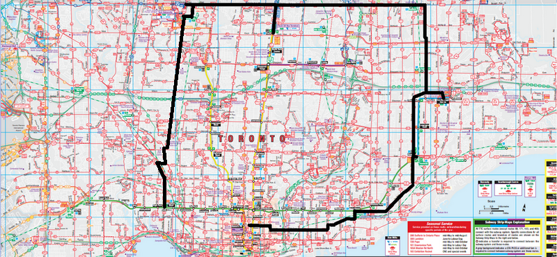
89 Bus to Wilson Avenue
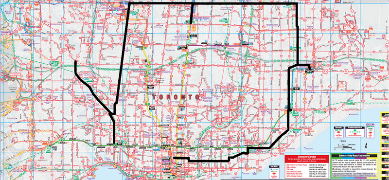
And so to Keele Subway Station. In the map above youÆll note that I will have retraced my route by boarding the #89 Weston bus northbound from Keele. Why? Because I needed to pass through a subway station and obtain a transfer, this time from Keele, so that I could transfer to the Wilson buses.
The driver is getting off as I get on; I ask her if this #89 connects with Wilson Avenue buses. She confirms that it does and asks if I have a transfer. ōYes!ö I reply proudly pulling my latest transfer from my shirt-pocket.
A few minutes later she re-boards her bus and walks down the aisle to give me a surface-route transfer (see the end of this web page). Oh, I ask, is my Keele Subway Station transfer not going to work? I am after all an innocent tourist, unfamiliar with the Toronto Transit Commission. Enigmatically she replies ōIt mightö.
What am I to make of this? She drives the #89 from Keele subway station which connects with the #96 and #165 every day, and yet she suspects that drivers on those routes wonÆt honour a valid transfer?
96 Bus to Wilson Subway Station
We pull up at Wilson on the north side of Highway 401 (not marked on your maps!). I got off the #89 bus near the circled area and turned the corner to find a #165 eastbound waiting for me. What Joy! A no-wait transfer.
As I approached it the #165 bus suddenly stopped idling and rushed away without me. Where have you read that before?
With the Toronto Transit Commission thereÆs always something to bitch about. I like that the #165 driver decided to run on schedule, but would it have crippled the system to wait not even thirty seconds for me? Is the driver of #165 unaware that the #89 has disgorged a passenger who is as we engage gears now walking purposefully towards the bus?
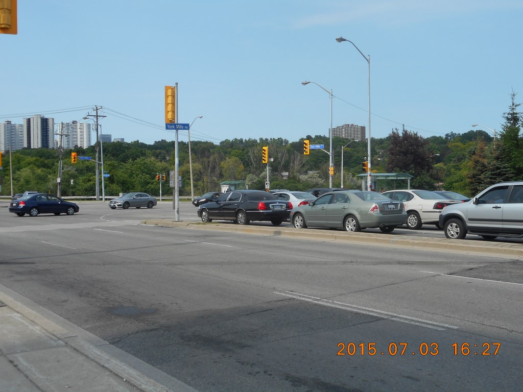
I amuse myself by taking a photo of the intersection at Albion Road and Wilson (DO pay attention!). ThatÆs the valley of the Humber River youÆre looking across.
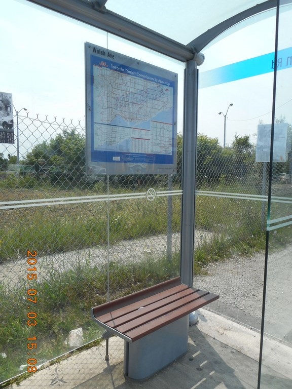
To further amuse myself I decide to confirm my next few legs with a study of the Toronto Transit Commission route map.
Which is mounted behind the seat, so that you embarrass the heck out of anyone sitting there.
But right now no one is sitting there, so I move as close as I can and still canÆt read the map, even wearing my map-reading spectacles.
So I decide to confirm my legs by hopping up onto the bench and study of the Toronto Transit Commission route map from a position where I can read it.
Given the fine-print on these maps, why does the Toronto Transit Commission mount them so high and behind barriers to viewing?
Why not mount them on the glass wall away from the bench, and at eye level? What do small children do to read the map?
Answer: The Toronto Transit Commission abdicated its role in bus shelters and handed the contract to Astra/Astral who care only for advertising, not customer convenience. ThatÆs why the shelters roofs let in rain in gusty rainy weather so that the seats remain wet long after the rain has stopped, and why the shelters are erected ONLY at busy intersections, even removing existing shelters rather than first placing a shelter at every bus stop.
Sigh!
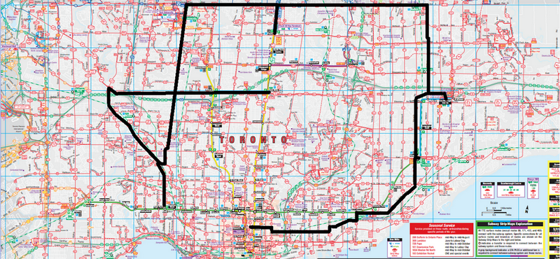
The map shows me traveling to York Mills on the Yonge line, but the truth is I hopped off at Wilson to get another transfer. My policy is to obtain a fresh machine-transfer at every possible stop. My trips take longer than they might, but itÆs a good idea to stretch the old legs, and IÆm on holiday ...
Eastwards along Wilson we cross Jane and start up the hill to Keele and I am filled with a very strange sense of deja-vu. Apart from the fact that I motored up and down here when I was working for Verifact some twenty-five years ago, I have a feeling that I was here just a few minutes ago.
Then it dawns on me: From Keele Subway Station we headed north-west, to the west of Keele Street, the southward leg from Steeles. Now I am heading east, making the third side of a triangle. Gave me quite a pause for thought there ...
96 Bus to York Mills Subway Station
Wilson Subway Station struck me as a transient terminal, but this whole business of stop-and-go may just be a feature of the Toronto Transit CommissionÆs perpetual behind-schedule mode of operation.
I drop down to the ticket wicket area and grab another machine-transfer and head back upstairs to board the following #96 eastbound to York Mills Subway Station.
95 Bus to Don Mills Road
From York Mills Subway Station I continue east on the #95. I am growing tired now. IÆve been six-and-a-half hours on buses and in gritty bus platforms. I am ready to head home, but will do it all by surface routes.
From York Mills I could have hopped on a subway train and been at my door within thirty minutes, but today I am determined to get my moneyÆs worth.
25 Bus to Pape Subway Station
I hop off the #95 at Don Mills and mirable dictu a #25 Don Mills southbound bus is waiting to cross the intersection and scoop me up on the SW corner, which it does.
I settle into a non-window seat and try to observe the passing scene.
When I began this trip at 9:30 the morning, peak period in Toronto was finished, but now we are deep in the afternoon peak period, and it is Friday. The bus is packed, seats are at a premium, and I have to resort to being an irascible old man and ask/indicate that a bag be moved from a seat to a lap, my bum being vastly more important than your bag.
People always comply, which is good.
However, Torontonians are too polite, and will elect to stand for a 40-minute journey, clutching to a strap or pole, blocking the aisle, and denying access to the rear of the bus by passengers who are trying to board the bus.
Torontonians are thus extremely selfish. ōI choose not to sit down, so why should it be easy for others to sit?ö.
I am rude and impatient and grumpy and important, so I push my way through the dense crowd, saying ōSorry!ö as if I meant it (A true Canadian!) and diminutive line-backer that I am worm my way to the rear of the bus.
My experience is that there is ALWAYS a seat at the rear of the bus, and if there isnÆt, by standing in the rear of the bus IÆll be in position to grab the next seat that becomes vacant.
I make no apologies for my behaviour. ōBunchingö of surface vehicles is caused by passengers, passengers who insist on exiting by the front doors, and passengers who slow the progress of passengers who try to exit by the rear doors. Buses need those hydraulic rams like those we see on garbage trucks, to compact all the passenger towards the rear. Where is Soylent Green when you need it?
72 Bus to Gerrard Street
Here I am in Pape subway Station. I exit and grab another machine transfer and wait for the next #72 southbound bus which would take me, if I let it, all the way to Cherry Beach(seasonal) if I let it.
But that is not for me today. Please see ōgrowing tiredö above.
It is a short trip, only eight minutes or so, until we arrive at Gerrard Street where a streetcar, doors open, is still taking passengers. I cross Pape Avenue and hop onto my last surface vehicle for the day.
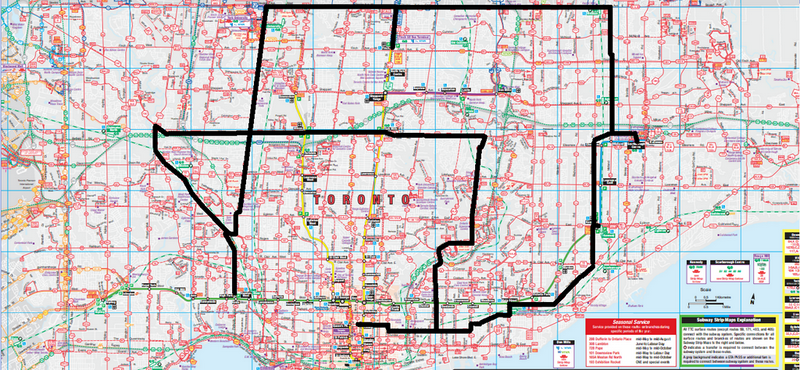
506 Streetcar to Bay Street
And this last leg, circled in green, is a reverse of my first leg this morning.
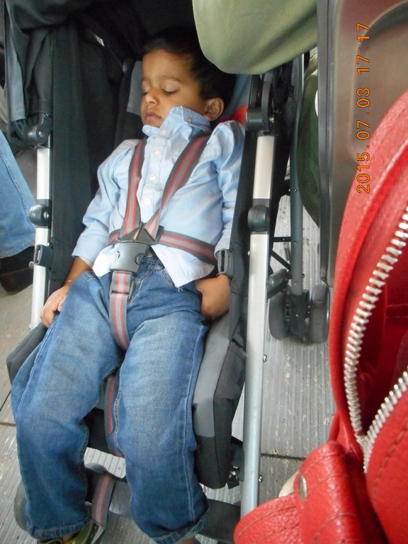
This little lad shows exactly how I feel.
And so back to my street.
I left here eight hours ago and have travelled lots of miles, all above ground, on a single ticket.
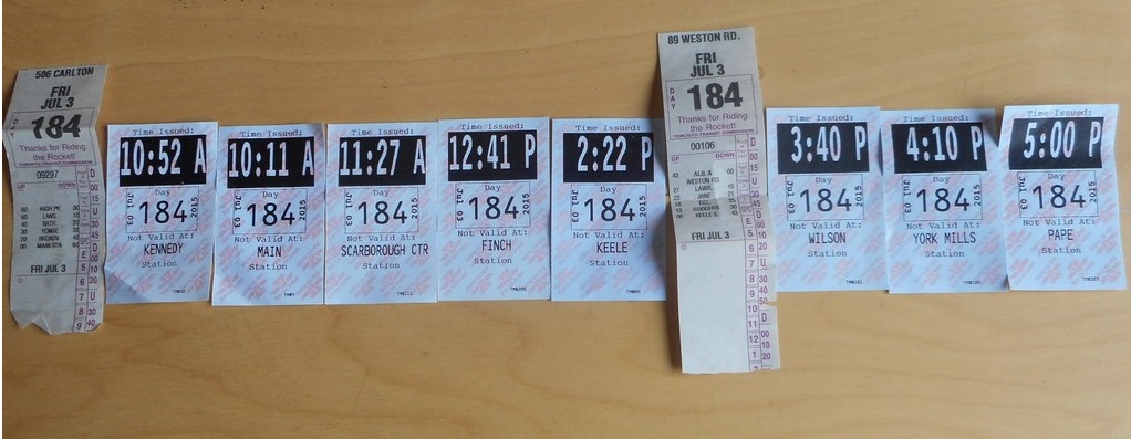
Here is my collection of transfers.
On the extreme left the streetcar transfer given to me as I boarded the eastbound #506 streetcar at bay and College. Near the centre to extra bus transfer handed to me by the #89 operator at Keele Subway Station. At the right-hand end the final transfer obtained from Pape Subway Station.
709 218 7927 CPRGreaves@gmail.com Bonavista, Friday, November 27, 2020 7:33 PM Copyright ® 1996-2020 Chris Greaves. All Rights Reserved. |
|---|