709-218-7927 The Landfall Garden House 60 Canon Bayley Road Bonavista, Newfoundland CANADA A0C 1B0 |
|
|---|
.JPG)
Remembrance Day
Tuesday, November 11, 2008
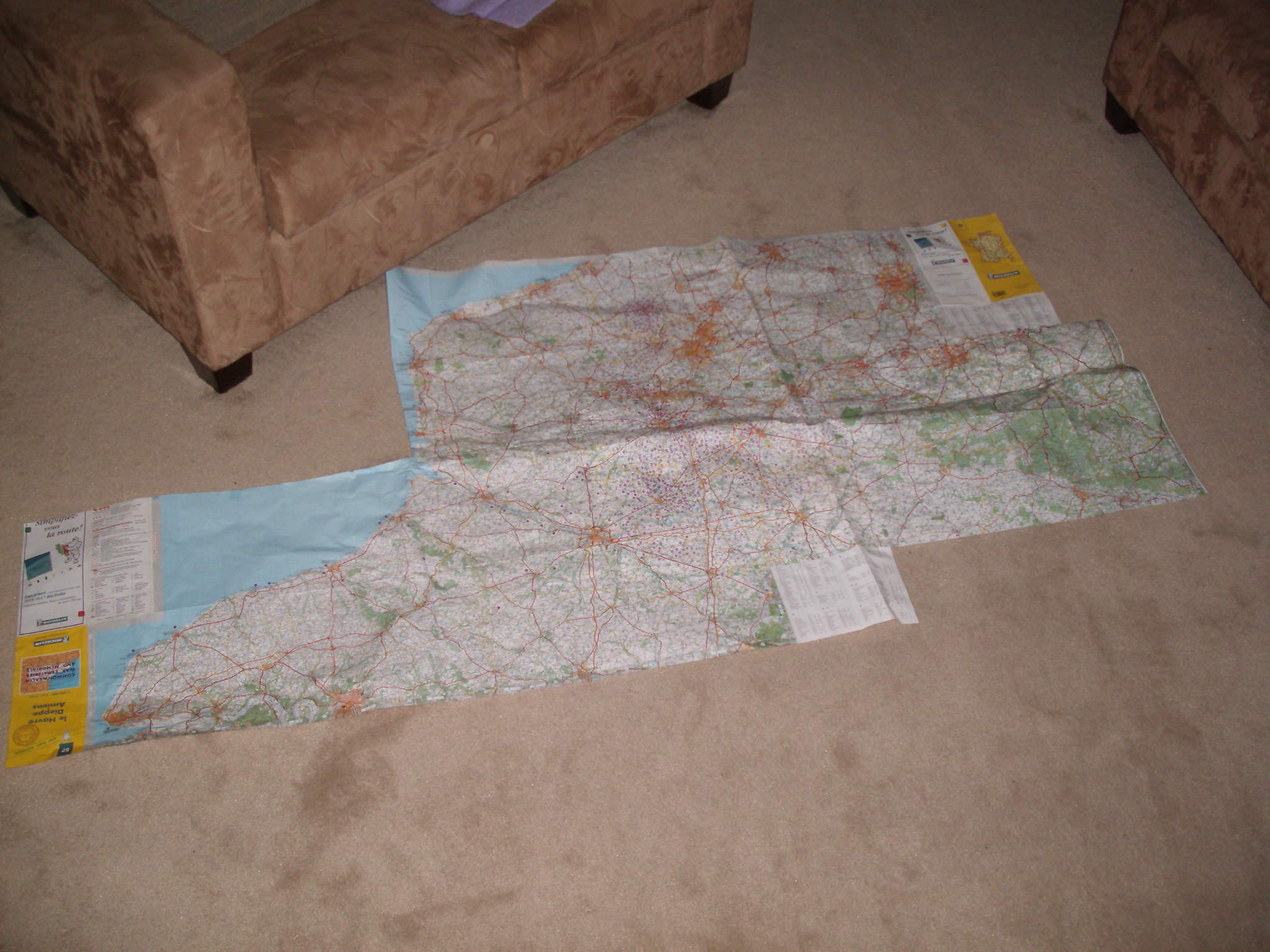
Here are three sheets from the Michelin series “Commonwealth Cemeteries and War Memorials”, maps 51, 52 and 53 pasted together.
In writing this note I note “Commonwealth”, and realize that this is only half the battle, so to speak.
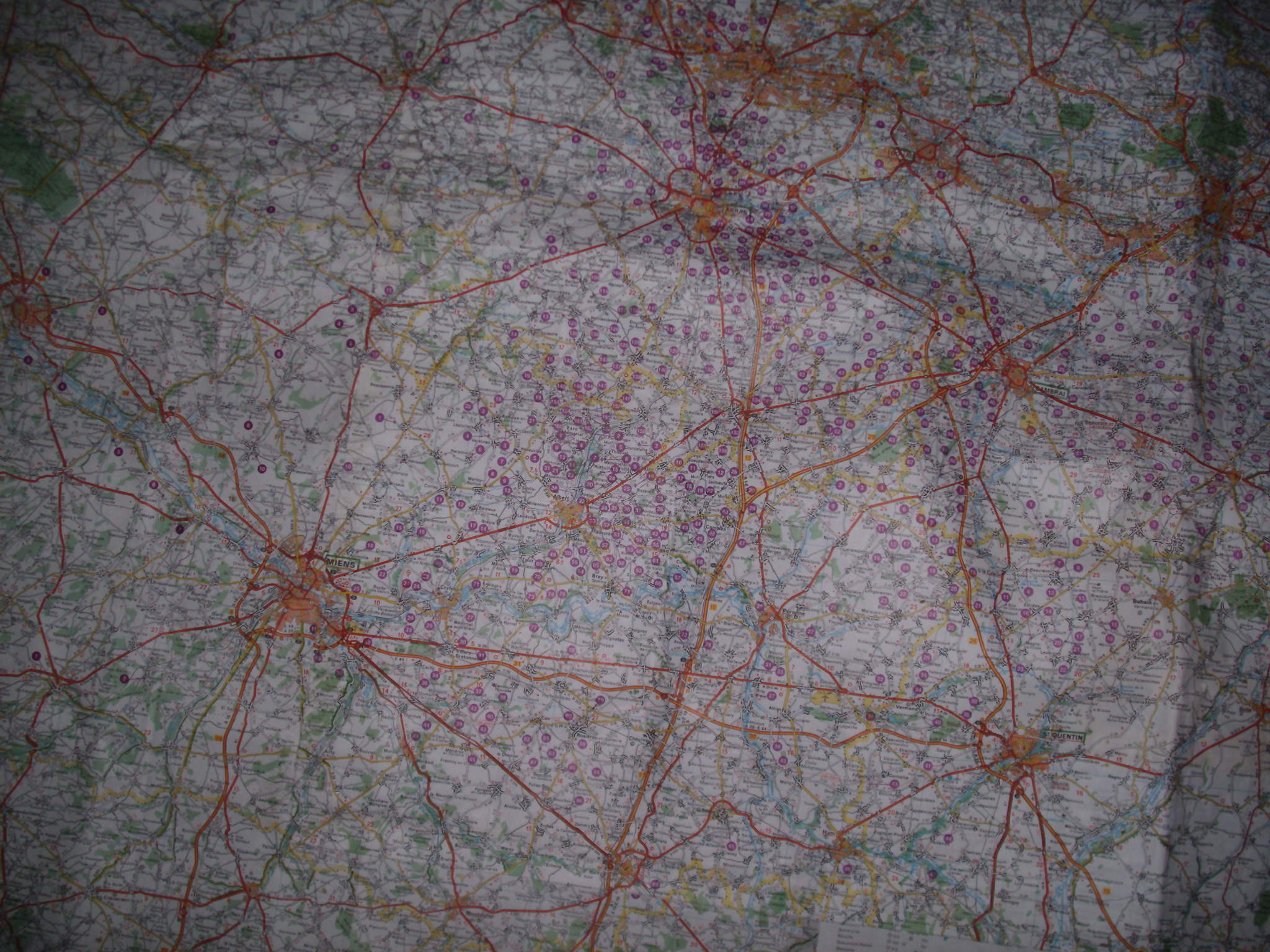
Here is part of the map in more detail. The purple marks are officially recognized cemeteries. They do not take account of private or unmarked graves behind farmhouses, or the bodies that were churned into dust and reburied repeatedly by high explosives.
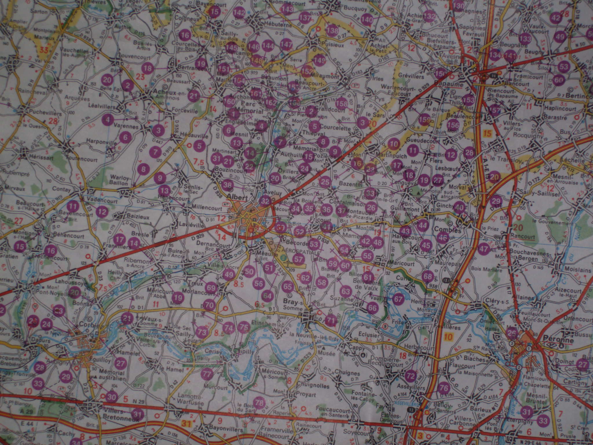
Even more detail, around the city of Albert in northern France near the border with Belgium.
Peronne lies at the lower right-hand corner of this image, Baupame at the top-right.
Google Earth tells me this is 50N and 2:47E, approximately.
709-218-7927 CPRGreaves@gmail.com Bonavista, Saturday, December 20, 2025 10:16 AM Copyright © 1990-2025 Chris Greaves. All Rights Reserved. |
|---|